Research & mapping
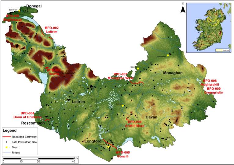
Phase 1 of the Black Pig’s Dyke project 2014 was undertaken by the Heritage Offices of Monaghan, Roscommon, Longford and Cavan county councils funded by the Heritage Council. An interdisciplinary research team of archaeologists, historians, GIS specialists and geophysicists, headed by Kilkenny Archaeology collated a large body of new information on the linear earthworks of the core study area, comprising counties Cavan, Monaghan and Leitrim, and north county Roscommon, north Longford and south Donegal.
Phase 1 of this project has sought to bring some clarity in relation to the many questions that endure about their extent, morphology, chronology and purpose by unraveling historical myths around the Black Pig’s Dyke from archaeological facts, and by attempting to present specific interpretations for each individual monument. Notwithstanding the lack of empirical evidence available the analysis conducted so far by the project has allowed for interpretative advances to be made.
It is evident from the research carried out to date that the linear earthworks can no longer be reduced to just one interpretation. With further research the unraveling of the enigma that is the Black Pig’s Dyke has the potential of unleashing many benefits including social, cultural, economic and academic at a local, regional and European level.


The full report of phase 1 of the project can be accessed below:
www.blackpigsdyke.ie
A major development in the regional cultural project was the development of a website, www.blackpigsdyke.ie, which was designed as a first online port-of-call for anyone interested in finding out more about the earthworks, and aggregated published information to date.
Archaeological research
Kilkenny Archaeology returned to the project in 2015 and undertook a series of archaeological excavations and testing of previous samples and finds, particularly from Aidan Walsh's excavations in Co. Monaghan.
In Co. Longford, an excavation took place at a roadside site in Tromra, north of Granard in February 2016. This was hugely exciting, as the full extent and nature of the monument was very clear in section beneath the late 19th century roadway. The excavation also revealed postholes and charcoal relating to a palisade fence, which was inserted into the top of the earthwork either at or after the time of construction.
Optically stimulated luminescence (OSL) testing was carried out on the soil within the earthen bank to try and determine the date of construction, from any quartz or mica present in the soil. The results from this test is expected from Oxford University in 2017. Radiocarbon dating was carried out on the charcoal, which placed it in the Iron Age, between 300 and 50 BCE, in line with testing elsewhere on the BPD and around the time of the timber toghers, or roadway at the Corlea Trackway.
